Mission Peak Closed. Ed Levin and Diablo could be impacted.
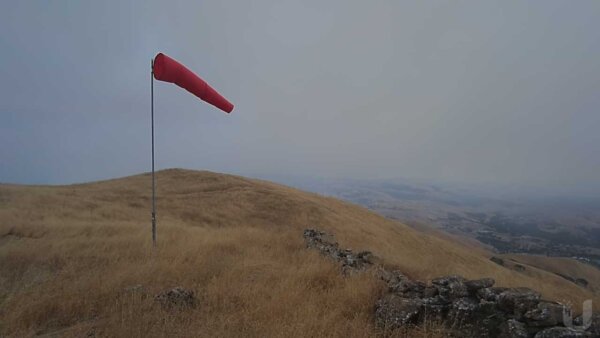
Mission Peak: Mission Peak has been closed due to a fire just to the east of Calaveras Reservoir.
Ed Levin: There is a fire located east of Ed Levin County Park. There is smoke around launch and it's possible there will be a TFR or park closure.
Diablo: There are multiple fires located in the vicinity of Mt. Diablo. A Temporary Flight Restriction has been issued just east of the summit. TFR information
How do we know if flying is allowed?
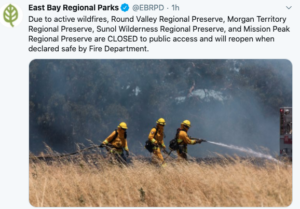
In the case of Mission, the park announced the closure via their social media feeds. Closures/ status updates are posted on twitter before anywhere else:
East Bay Parks (Mission Peak): https://twitter.com/EBRPD
Santa Clara County Parks (Ed Levin): https://twitter.com/SCCParks
California State Parks (Diablo): https://twitter.com/CAStateParks
Twitter post announcing the closure:
Wildfires & Temporary Flight Restrictions
Wildfire season is now in full force, so we wanted to send out a few reminders related to fire season.
A Temporary Flight Restriction (TFR) will be issued for larger fires (typically those which require multiple days to extinguish). TFRs are found on the FAA website: https://tfr.faa.gov/tfr_map_ims/html/cc/scale5/tile_2_8.html but it's often easier to use a website like https://skyvector.com/ which has a better user interface. TFRs can cover large areas and long periods of time. However, it takes some time and coordination for a TFR to be issued, so if a new fire pops up, don't expect one right away. We are not allowed to fly in a TFR.
If there isn't a TFR, and the park hasn't been closed, then it's likely we're legally allowed to fly, but it's always our legal responsibility to yield way to all aircraft. The last thing we want to do is be a distraction or hazard to the wildfire efforts. It's best to remain well clear if possible.
Fire Traffic Areas
When CAL FIRE is working a fire, they'll designate the airspace around as a "Fire Traffic Area." This generally extends 12 nautical miles away from the fire boundary, and the lowest aircraft, helicopters, will typically be operating at a maximum altitude of 500' AGL.
In addition, there will be common routes (unknown to us) that the various aircraft will use to get to and from the FTA.
Long story short, please be aware that our flying may be impacted via TFRs, park closures, or an increase in fire fighting aircraft, even many miles away from the fire.
Thanks,
The WOR Executive Committee |